
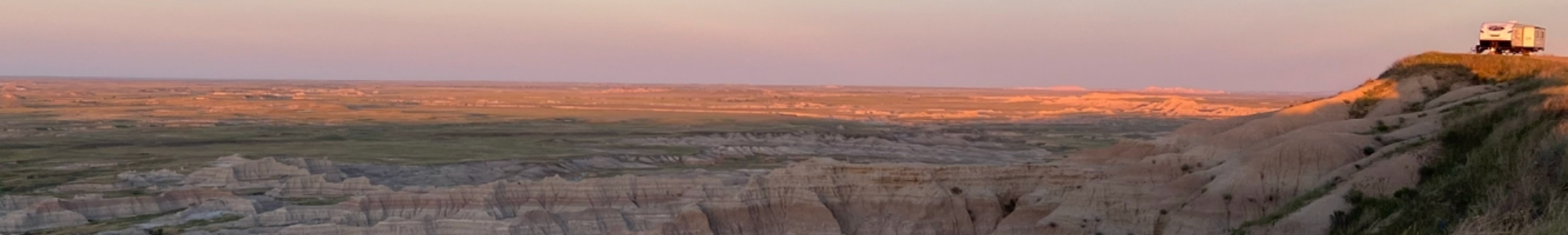
The Black Hills of South Dakota have long been treasured by the Native American tribes that once inhabited these lands and early American pioneers, and it is easy to see why. Rolling hills, granite cliffs, green meadows and mountain streams all combine in this area to form an intricate and beautiful collaboration of sights and sounds that thrill the senses. Fortunately, much of this land is protected by the federal and state governments, ensuring that people will be able to enjoy the area for generations to come.
One of the best ways to experience the Black Hills is take in the sights from the scenic drives in the area. Whether by car, truck or motorcycle these roads provide an exhilarating glimpse of the land the Lakota indians called “Paha Sapa” (the hills that are black).
Table of Contents
Location (Near Mount Rushmore & Sturgis)
The Black Hills are the oldest mountains in the US and are located in the area west of Rapid City, SD. Technically speaking, the Black Hills mountains are found on the western edge of South Dakota and the eastern border of Wyoming. Three of the four bucket list drives explore the area around Mount Rushmore and Custer State Park, while the fourth (Spearfish Canyon Scenic Byway) is northwest of Rapid City, near the South Dakota towns of Deadwood and Sturgis. We used the area around Mount Rushmore and Custer State Park as our “home base” during our recent visit which made these roads a very convenient and exciting way to explore the area.
1. Needles Highway

The Needles Highway (also known as Hwy 87) is a beautiful drive that runs from Hwy 16A in the park up to the north west corner of Custer where Sylvan Lake is located. This 14 mile road is part of the Peter Norbeck Scenic Byway and was once thought to be impossible to build by many engineers. However, through hard work and dedication it was completed in 1922.
This spectacular drive twists and turns its way through forests of pine and spruce, across sunny meadows, and up rugged mountains. The highway’s name is derived from the rugged granite spires (tall granite towers) that rise majestically into the air. The road terminates at Sylvan Lake after passing through Needles Eye Tunnel, a one-lane tunnel carved into a mountain of granite that measures only 8’9″ wide by 9’8″ tall.
The roads namesake comes from the “Needles Eye”, a unique rock formation created by years of erosion from wind and rain during freeze and thaw cycles. Expect a 45-minute drive one-way from end to end.

The Needles highway typically closes with the fist snow of the season (often in October) and reopens around April 1st (depending on road conditions). Visitors will pass through 2 unique tunnels during the drive. The Needle’s Eye Tunnel (located near the Needle’s Eye rock formation, close to Sylvan lake) measures 8’9″ wide and 9’8″ high. The Iron Creek Tunnel (located near the Iron Creek Horse Camp) is the same width, but measures slightly taller at 10’10” high.

Directions to Needles Highway

The needles Highway is located inside of Custer State Park and is typically considered to start at the junction of Hwy 87 and playhouse road and end at Sylvan Lake. From Rapid City, Head south on Highway 79 for Approximately 15 miles. Turn right onto Highway 36 and continue for approximately 9 miles to the entrance of Custer State Park. Since the Needles Highway is located within the park, you will have to pay the entrance fee ($20/vehicle as of July 2020). Continue for another 8 miles and then turn right onto Highway 87. The needles highway officially begins 4 miles later when you turn left, continuing on Highway 87.
2. Iron Mountain Road

Iron Mountain Road is the portion of Hwy 16A that travels north after entering Custer State Park from the east on Hwy 36. This 17 mile stretch of highway, is yet another example of determination and ingenuity. The road was specifically designed with 314 curves, 14 switchbacks, and 3 one-lane tunnels in order to force visitors to go slow in the hopes that they truly enjoy and take in the scenery during their drive.


“This is not meant to be a super highway. You’re not supposed to drive here at 60 miles per hour, to do the scenery justice you should drive at no more than 20. To do it full justice you should just get out and walk it.”
Peter Norbeck
The southern portion of the road begins in Custer then leaves the park after a few miles and ends at Mount Rushmore National Monument. Along the way, visitors are treated to the scenic beauty of the Black Hills including many overlooks and beautiful pine forests. In a feat of engineering creativity, you’ll cross over wooden “pigtail” bridges (bridges that loop over their own road as they climb) on your journey toward Mount Rushmore.
As you near the end, be on the look out for Doane Robinson Tunnel. This tunnel carved through the mountain is 13’2″ wide and 12’2″ tall and was designed to perfectly frame mount Rushmore while you’re heading north. It is quite an impressive site.

Other tunnels along the route include the C.C. Gideon Tunnel which measures 11’6″ wide and 10’9″ high, and the similarly sized Scovel Johnson Tunnel (10’9″ wide and 11’0″ high). Iron Mountain Road closes periodically during the winter depending on snowfall and road conditions. Expect a 40-60 minute drive one way along this route.
Directions to Iron Mountain Road

The Iron Mountain Road originates at the eastern edge of Custer State Park, but leaves the park on its way to Mount Rushmore where it terminates. It starts at the junction of Highway 16A and Highway 36 at the east entrance of the park and heads north until it ends at the junction of Highway 16A and Highway 244 near Mount Rushmore.
From Rapid City, Head south on Highway 79 for approximately 42 miles, then turn right onto Highway 36. Continue for another 9 miles and turn right onto Iron Mountain Road.
3. Custer Wildlife Loop Road

This 18 mile scenic loop is located within Custer State Park. It travels through the south end of the park and winds through open grassy meadows, hills dotted with pine, and crosses clear flowing streams. Depending on the day, you can see antelope, deer, coyotes, prairie dogs and Custer’s famous begging burros on your drive.

But, perhaps the most well-known feature of the drive is Custer’s bison herd. At over 1,500 animals strong, this herd roams the grasslands in the parks southern end and can almost always be seen from the road. It is not uncommon to be caught in a “buffalo jam” when the herd chooses to stop on and around the roadway. We have seen and experienced cars completely surrounded by bison and it makes for an extremely unique experience.
There are several dirt roads (Fisherman’s Flat Road, North Lame Johnny Road, Swint Road, and Oak Draw Road) located within the Wildlife Loop area. All of these are open for your use and allow you to explore deeper into the park.
We recommend making this drive either early in the morning or later in the evening. Due to the cooler temperatures, the wildlife tends to be more active during these times of day. Depending on “buffalo jams”, and whether you stop to feed the boroughs, we recommend planning around 1 hour to 1 1/2 hour for this drive.
Directions to Custer Wildlife Loop Road

Since this scenic drive is located entirely within Custer State Park, you will have to pay the park entry fee of $20 in order to enjoy this experience, but it is well worth the cost. From Rapid City, Head south on Highway 79 for approximately 42 miles, then turn right onto Highway 36. Continue for another 9 miles to enter the park and another 2 miles before making the left turn onto the Wild Life Loop Road.
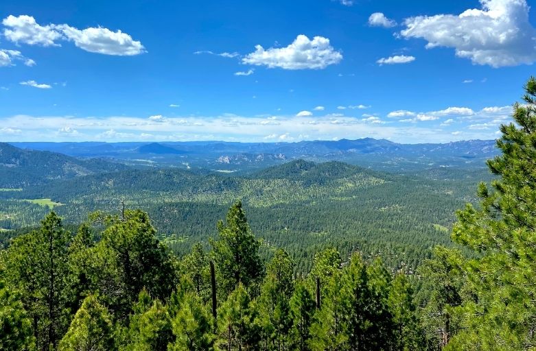
4. Spearfish Canyon Scenic Byway

The Spearfish Canyon Scenic Byway is the portion of Highway 14A that passes through Spearfish Canyon. Located 18 miles West of Sturgis, SD off of I-90, this drive is considered by some to be the most spectacular in the Black Hills. Prepare yourself for 22 miles of breathtaking scenery as you wind through the canyon floor passing waterfalls, evergreen and deciduous trees along the way.
Bridal Veil Falls (located approximately 6 1/2 miles south of the byway entrance) is arguably the most famous waterfall on the route, however there are numerous other scenic pull-offs which allow visitors to take in the beauty of the shear limestone walls forming the canyon. In addition, several trails lead from these pull-off areas to allow travelers to venture further into the canyon and experience more of the beauty it is known for.
Although it is only 19 miles in length, We recommend planning at least an 1 hour – 1 1/2 hours for this drive, which allows time to slow down stop and enjoy the scenery along the way.
Directions to Spearfish Canyon Scenic Byway

Spearfish Canyon runs on Highway 14A from its intersection with I-90 (in Spearfish, SD) south to where it intersects with Highway 85 just southwest of the town of Lead, SD. From Rapid City, head west on I-90 for approximately 45 miles, getting off the interstate at exit 14. This is the beginning of highway 14A, although you don’t actually enter the canyon until slightly past the Spearfish Canyon Country Club (approximately 2.5 miles further down the highway.
Pingback:Top 10 Things to Do Near Mount Rushmore And Custer State Park – S'more Time Together